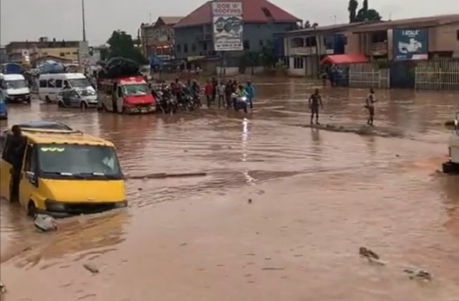
Accra experienced devastating floods in June 2026, resulting in at least 12 fatalities, seven missing persons, and the displacement of nearly 40,000 residents. This severe event, which also claimed 20 lives in Côte d’Ivoire, highlights the ongoing vulnerability of Ghana's capital to heavy rainfall.
The persistent flooding occurs despite significant investments in large-scale infrastructure projects, including the GHS 528 million (US$44 million) proposed Atomic ponds. These ponds are part of the World Bank-backed Greater Accra Resilient and Integrated Development (GARID) project. However, recent research indicates that these large upstream detention basins would only marginally reduce flood peaks, by 8–13%, and flood volume by 2–4%.
Accra's recurrent flooding is a critical economic and social issue, impacting livelihoods and infrastructure across the city. The June 2026 deluge, with 593.2mm of rainfall, marked Ghana's wettest month since 1995. Even ordinary storms, such as the 132mm in May 2025 that killed four people, including a child in Nima, cause significant damage. This pattern underscores a systemic problem rather than just extreme weather events.
A study by Acheampong, Gyamfi, and Arthur in 2023, which simulated the two proposed Atomic ponds, revealed their limited effectiveness. The study found that the benefits of these large basins diminish significantly during severe storms. The core issue is that required storage capacity increases exponentially with the desired flood reduction, and the city's choked exit to the sea remains a critical bottleneck.
Experts suggest that Accra's flooding is a solvable systems problem, not merely a weather phenomenon. The current approach, focused on large detention ponds, is being questioned. The proposed Atomic ponds, conceived after the deadly June 3, 2015 flood-and-fire that killed over 150 people, have faced delays and are not yet built.
A new model, developed through an intuitive inquiry, proposes an alternative strategy: a network of approximately 120 small basins. These basins would be located in mapped depressions across all five Greater Accra systems, covering 458 km². The model also advocates for restoring coastal wetlands to act as a self-cleansing buffer, enhancing the city's natural resilience.
This distributed resilience approach aims to clip local flood peaks at their source, rather than attempting to manage massive volumes of water at a few central points. The current problem is not a lack of intelligence among Accra's engineers, who have understood drainage mechanics since master plans in 1963, 1991, and 1995. Instead, it is a failure of framing, focusing on large, centralized solutions.
The GARID project, extended to 2027, has undertaken valuable work in dredging, waste management, and early warning systems. However, its primary focus on the Odaw River, which carries about 60% of Accra’s stormwater, leaves other flood-prone areas like Weija, Tse Addo, Ashaiman, and Kpone vulnerable. The fundamental challenge remains the limited capacity of the channel and lagoon to convey water out to sea, exacerbated by silting and waste.
Decision-makers and urban planners must reconsider the efficacy of large-scale flood control projects in light of this new evidence. The shift towards smaller, distributed defenses and ecological restoration offers a more sustainable and effective path forward for Accra. This approach could significantly improve the city's resilience to future rainfall events and protect its residents and economy.